


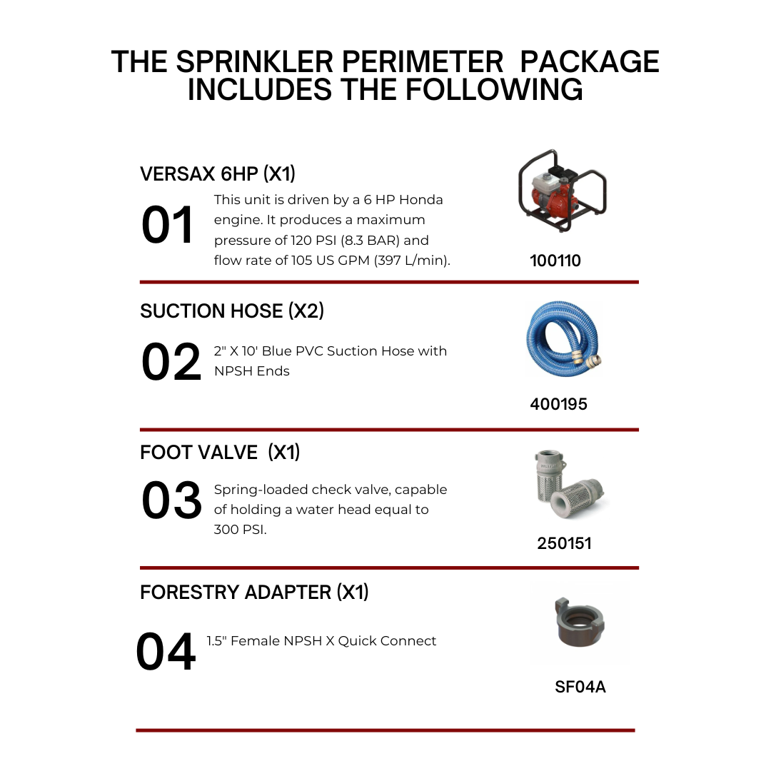
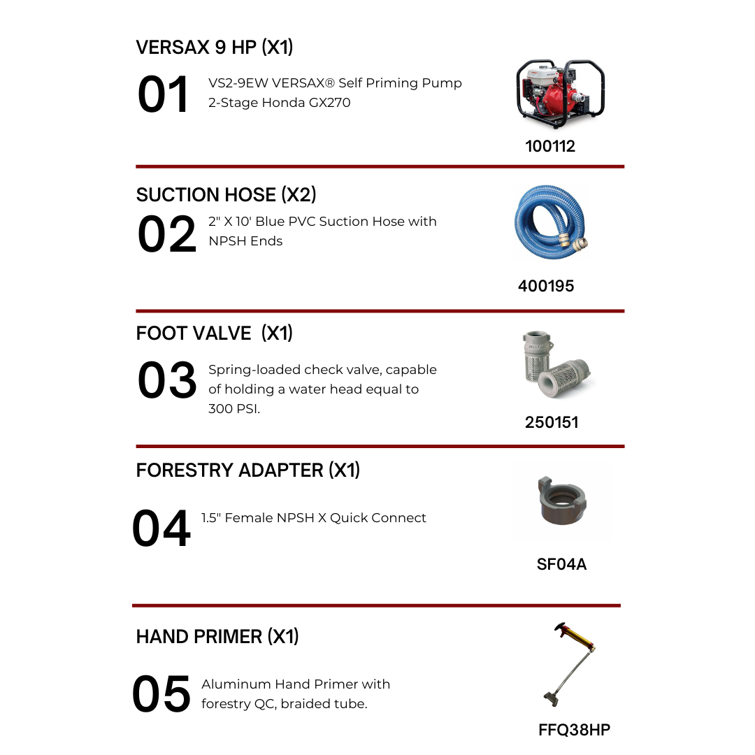
The pine beetle—whether mountain pine beetle in the West or southern pine beetle in the East—is one of the most destructive agents in North American forests. Outbreaks have killed millions of acres of trees, reshaped landscapes, and fueled cascading wildfire risks. These infestations have intensified in recent decades due to warming winters, hotter summers, and widespread monoculture stands of pine.
Pine beetles kill trees by boring under the bark and introducing fungal pathogens, cutting off the tree’s ability to transport water and nutrients. Entire stands can be lost within a few seasons if infestations go unchecked. For land managers, utility providers, municipalities, and property owners in fire-prone regions, the beetle is not just a forestry issue—it’s a wildfire readiness challenge.
The most effective response is multi-layered: early detection, aggressive direct suppression, preventive stand management, and adaptive strategies built on predictive modeling.
1. The Infestation Problem
Biology of the Threat
Pine beetles are small bark beetles that mass-attack trees. Once they penetrate the bark, they release pheromones to attract others, overwhelming the tree’s defenses. Female beetles lay eggs under the bark, and larvae feed on inner tissues. Simultaneously, the beetles introduce blue-stain fungi that clog the tree’s vascular system.
Signs of infestation include:
Pitch tubes (resin blobs) on bark
Fine boring dust at the base of the tree
Needles shifting from green to red, then gray
Wood stained blue from fungal spread
A single tree can support thousands of beetles. Outbreaks scale rapidly because adjacent pines, especially dense, same-aged stands, are highly vulnerable.
Climate and Range Expansion
Historically, cold winters controlled beetle populations. Warmer winters now allow survival into new areas. Hot summers accelerate life cycles, with some species completing more than one generation per year. The result: larger, faster, and more sustained outbreaks.
2. Monitoring and Early Detection
Ground-Level Surveillance
Early detection is critical. By the time crowns turn red, beetles have usually dispersed. Foresters use traps baited with pheromones in spring to monitor populations and forecast risk zones. Crews also scout for pitch tubes and boring dust during late spring and summer.
Remote Sensing Technologies
Advances in satellite imagery, aerial surveys, and machine learning now allow detection of stressed trees before visible color change. Time-series analysis of canopy reflectance can flag anomalies weeks earlier than the human eye, buying time for intervention.
Predictive Modeling
Outbreak forecasting combines historical catch data, stand composition, and climatic variables to pinpoint where beetles are most likely to build epidemic populations. These models help agencies prioritize limited resources and direct suppression where it matters most.
3. Direct Suppression Tactics
Cut-and-Remove
Infested trees are felled and hauled to mills or disposal sites before the beetles emerge. This works when infestations are caught early and wood is still merchantable.
Cut-and-Leave
Where hauling isn’t viable, crews fell infested trees and leave them on site. Exposed logs dry faster, killing beetle broods. Often buffer trees are also felled to prevent escape.
Pile-and-Burn / Fall-and-Burn
In inaccessible areas, infested logs are piled and burned, or trees are felled and burned directly. Burning is typically scheduled for winter to reduce wildfire hazard.
Sanitation and Salvage Harvesting
Sanitation harvesting removes small pockets of infestation, while salvage harvesting targets larger stands—even those not yet showing visible attack. Salvage can also recover economic value from dead timber.
4. Preventive Stand Management
Thinning
Overly dense stands provide ideal beetle habitat. Thinning reduces competition, improves tree vigor, and makes it harder for beetles to mass-attack.
Prescribed Fire
Low-intensity prescribed burning reduces stand density, eliminates stressed host trees, and encourages mixed-species regeneration. Healthy, diverse forests are more resilient to beetle attack.
Insecticide Protection
For high-value trees—such as those near facilities, utility corridors, or recreational areas—preventive insecticide sprays can provide seasonal protection. These treatments must be applied before beetles attack and are typically used selectively due to cost and environmental concerns.
Biopesticide Trials
Research shows that compounds like chitosan can boost resin flow, enhancing a tree’s natural defenses and disrupting beetle reproduction. While still experimental, these treatments represent a promising supplement to traditional tools.
5. Systemic Strategies
Large-Scale Control Campaigns
Provincial and state forestry agencies have demonstrated that sustained, coordinated action works. Intensive cut-and-control programs in Canada reduced beetle-killed trees per hectare dramatically over the past decade.
Agent-Based Modeling
Computer simulations that mimic beetle dispersal, stand dynamics, and management options allow managers to test strategies virtually before deploying them in the field. Models consistently show that aggressive salvage harvesting outperforms piecemeal sanitation once infestations spread widely.
Dispersal Insights
Most beetles disperse only a short distance from their host tree, but a small fraction travel kilometers away. These rare long flights are disproportionately responsible for outbreak spread. Management must therefore target both local suppression and landscape-scale risk.
6. Secondary Consequences: Fire and Ecosystem Risk
Dead, beetle-killed trees alter fire dynamics. During the first two years after attack, red needles increase crown fire hazard. Once needles drop, fire risk in the canopy declines, but heavy downed wood contributes to surface fire intensity.
Beetle outbreaks also alter hydrology, wildlife habitat, and carbon storage. The loss of live canopy increases water runoff, reduces shade, and disrupts habitat for dependent species.
7. Utilization of Beetle-Killed Wood
Dead timber can still be used. Salvage operations have supplied wood for dimensional lumber, oriented strand board, and pulp. Beyond industrial use, beetle-killed pine is being repurposed into value-added products like guitars, skis, and furniture.
Emerging markets also include biochar production and compost inputs—ways to return carbon to the soil while reducing slash buildup.
8. Recommendations for Land Managers and Communities
Invest in Detection
Deploy pheromone traps, aerial surveillance, and remote sensing to identify hotspots early.
Train staff and contractors to recognize early bark symptoms.
Act Quickly
Infested trees should be removed or treated before beetle emergence. Delays multiply the problem.
Manage Stand Density
Incorporate thinning and prescribed fire into routine forest management.
Promote mixed-species, mixed-age stands for resilience.
Protect High-Value Assets
Use targeted insecticides only where trees provide critical infrastructure protection or economic value.
Model Before Acting
Utilize predictive and agent-based modeling to prioritize interventions and maximize efficiency.
Leverage Salvage and Markets
Partner with mills, utilities, and secondary industries to ensure beetle-killed wood is utilized rather than wasted.
Stopping pine beetle infestations requires a layered defense strategy. No single tactic—whether thinning, spraying, or cutting—works in isolation. Success comes from integrating detection, direct suppression, preventive management, and adaptive modeling into a coherent framework.
For stakeholders in wildfire-prone regions, the stakes are higher than timber value. Beetle infestations magnify fire risk, destabilize ecosystems, and threaten infrastructure. But with early action, data-driven planning, and commitment to proactive management, communities and agencies can stay ahead of the beetle curve.
The lesson is clear: act early, act decisively, and treat the pine beetle not as a minor forestry nuisance but as a landscape-level hazard demanding continuous vigilance and innovation.
-

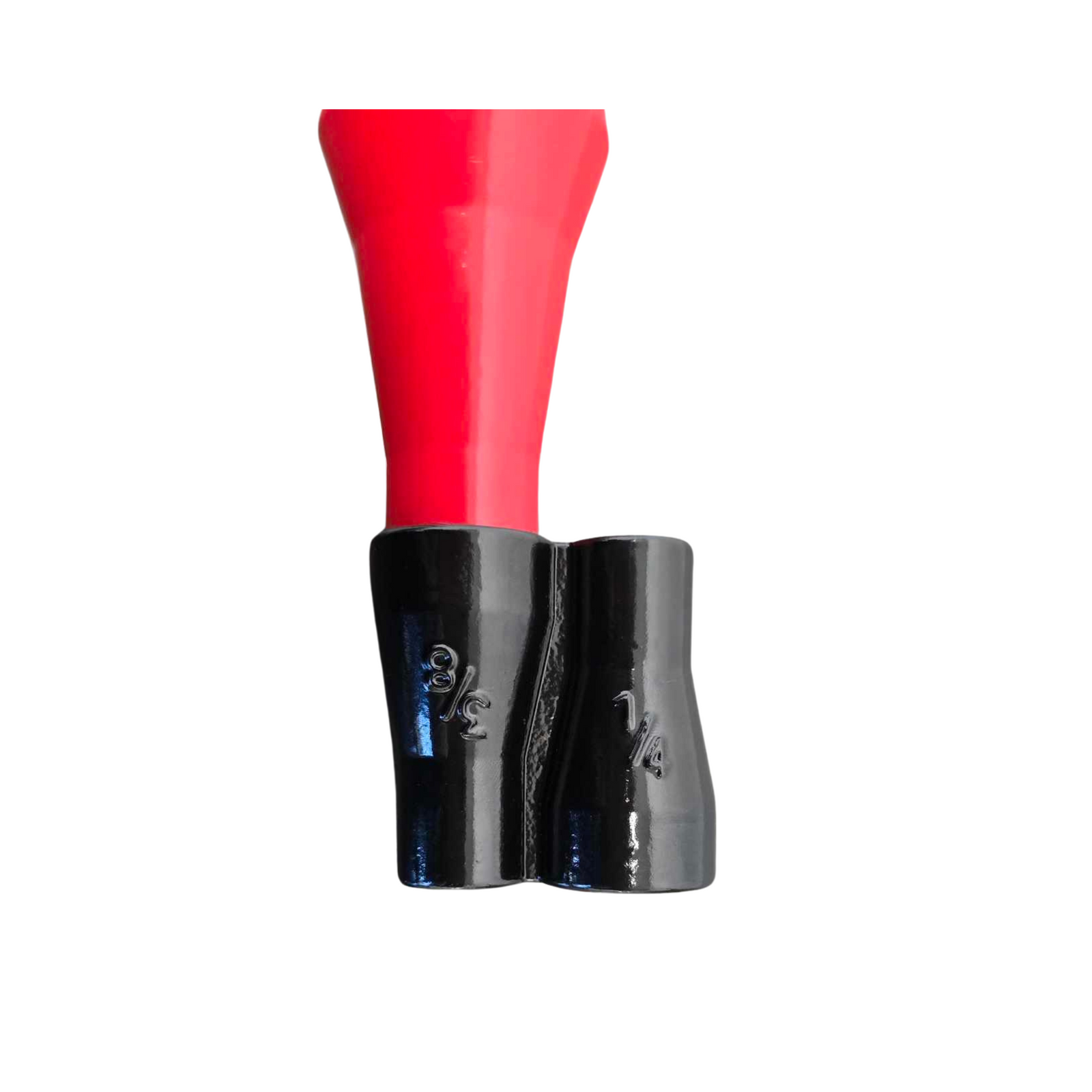
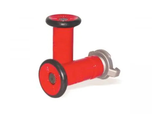
Rancher Series
The RANCHER® is a professional firefighter-grade system that comes with top-of-the-line components...


Folding Roof Top Sprinkler
$49.95 CAD
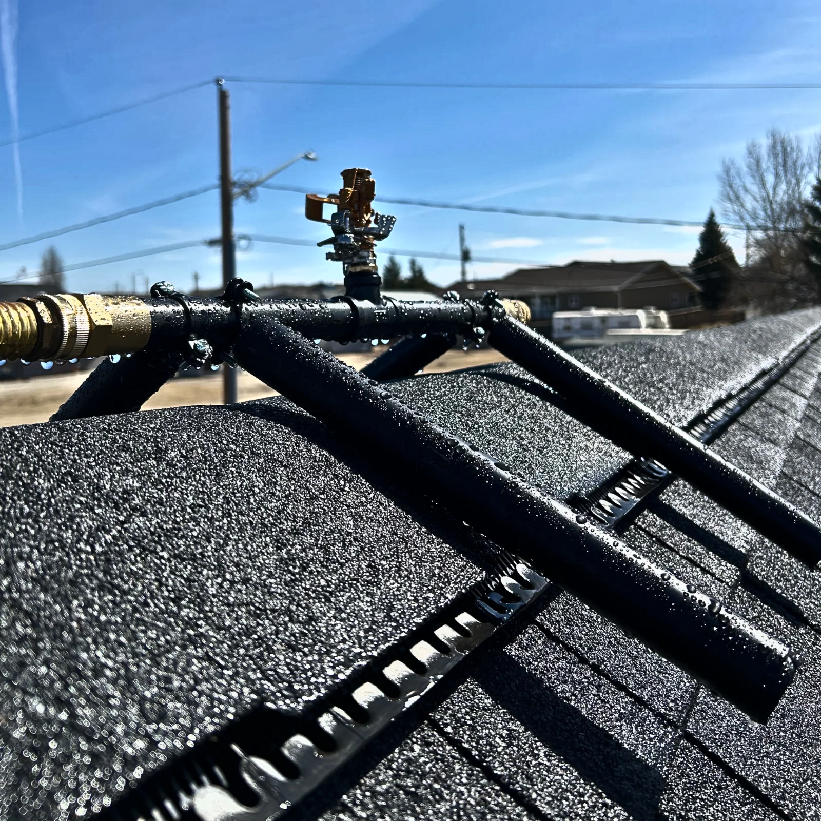
The Folding Roof Top Sprinkler is designed to enhance wildfire defense by wetting the roof...

Mounted Roof Top Sprinkler
$68.20 CAD
Wildfire Roof Sprinkler System – Mounted for Maximum Ember Defense The Mounted Roof Top Sprinkler...

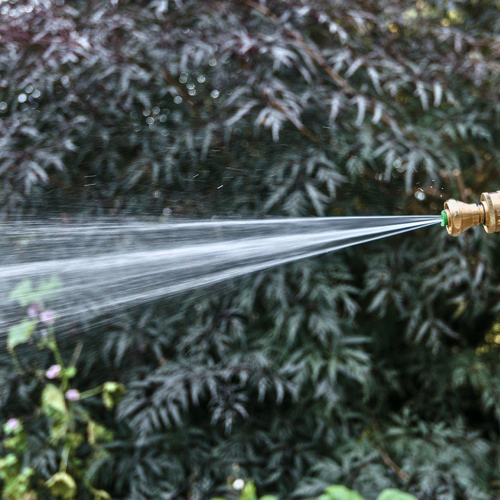
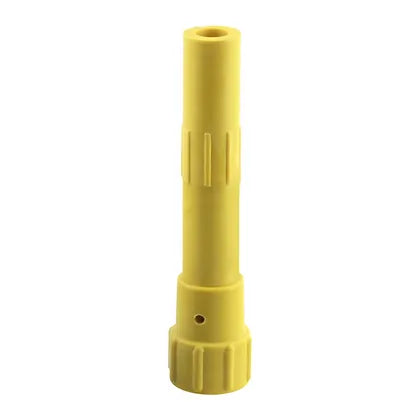
Brass Sweeper Nozzle
$13.13 CAD
Built from solid brass for durability and resistance to corrosion. It delivers a high-pressure, focused...
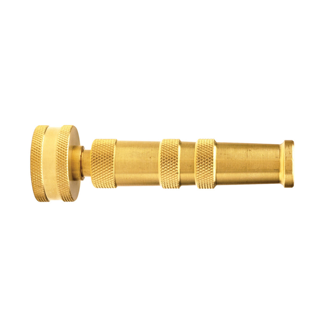

Brass Twist Nozzle
$31.49 CAD
Attributes Maximum Operating Pressure 150 PSI (water only) Weight 0.375 lb Break Quantity 1 Optional...
Sold out


1.5"/2" Forestry Spanner Wrench
$18.00 CAD
For use in coupling and uncoupling 1" (25mm), 1.5" (38mm), 2" (51mm) hose line couplings,...


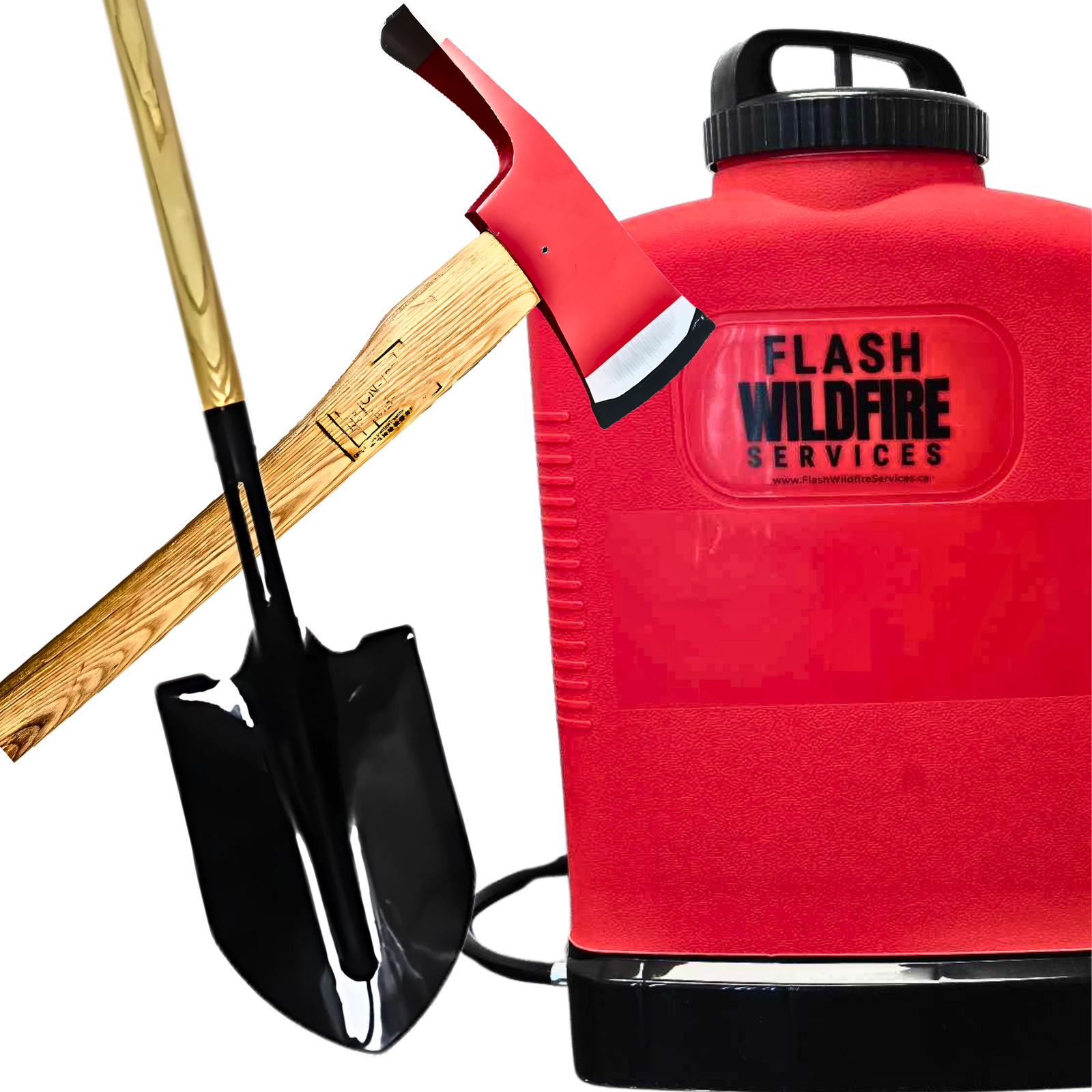
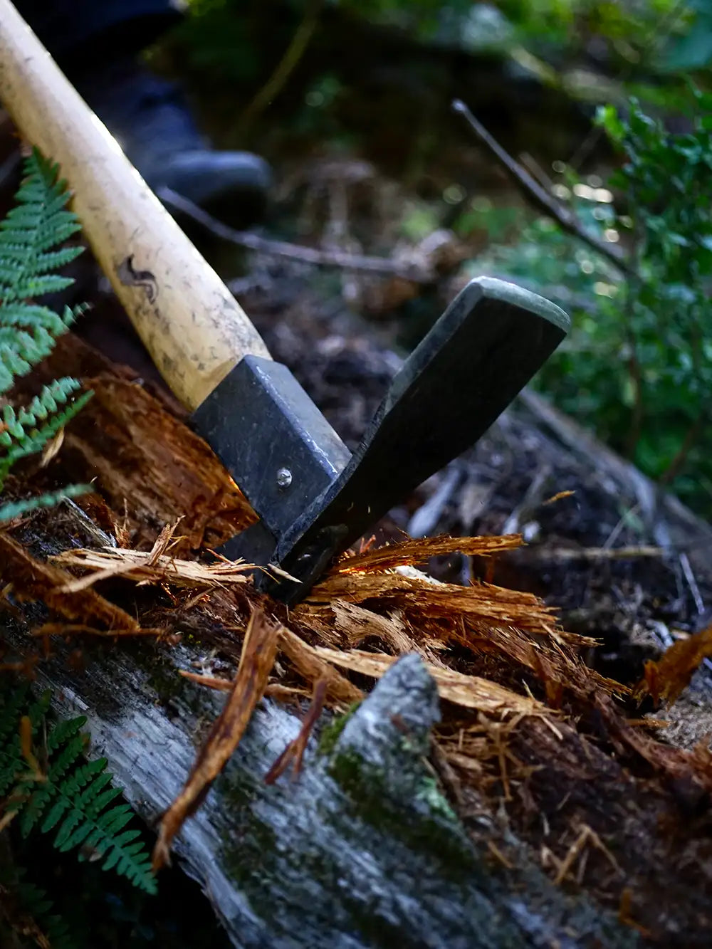
Pulaski Axe – Wildfire Brush & Root Removal Tool
$55.00 CAD
The Pulaski axe is a trusted tool for wildfire home defense. Its forged steel head...
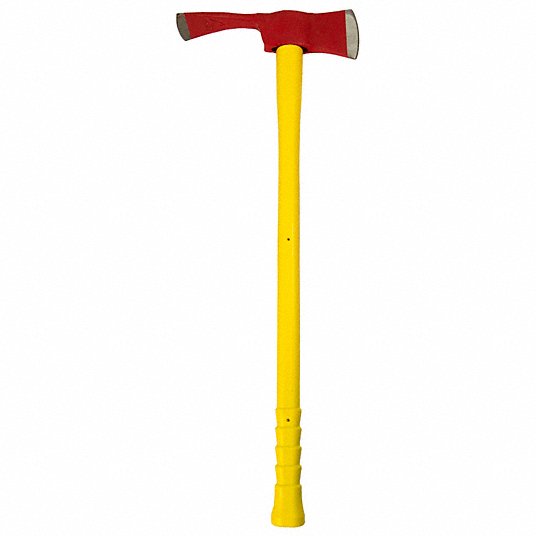
Pulaski Axe – Fiberglass Handle Wildfire Tool
$55.00 CAD
The Pulaski axe is a go-to tool for wildfire home defense. This model features a...


Round Mouth Shovel – Long Handle Wildfire Tool
$24.50 CAD
Shovel – Round Mouth 42" Hardwood Handle, Tempered Steel Blade Product Overview This round mouth...


Fire Swatter
$55.00 CAD
The Fire Swatter is a basic tool for smothering grass fires, embers, and surface flames. It...

Professional Fire Fighting Broom
$69.04 CAD
Used for fighting fires in the grass and underbrush Used in fire line construction and...


MS 362 C-M 20" Chainsaw
$1,059.99 CAD
MS 362 C-M gas chainsaw: a versatile chainsaw for professional use If you want to...

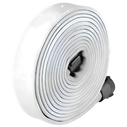
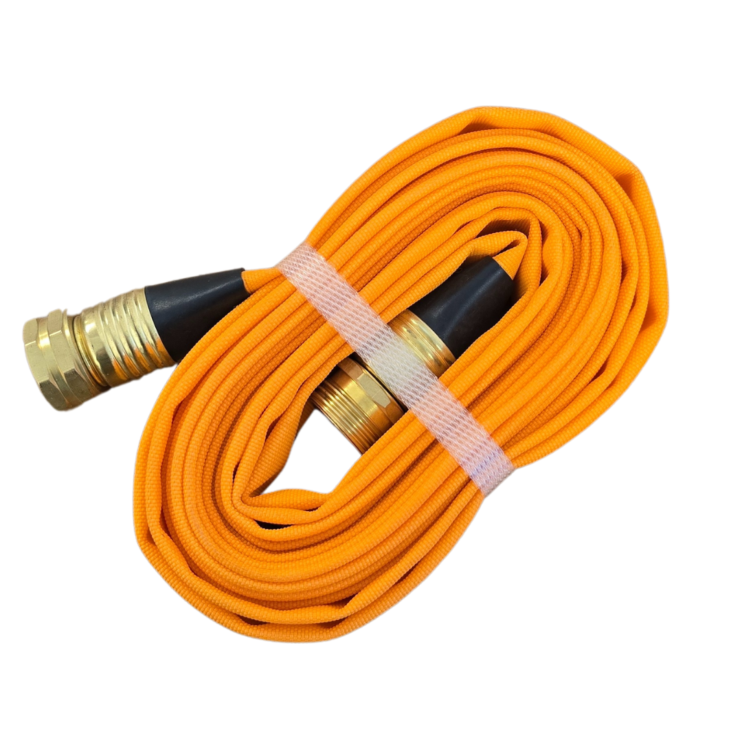
WX-187-I Synthetic Type I Forestry Lay Flat Hose - 1.5 X 50
$170.10 CAD
The WX-187-I is a remarkably lightweight synthetic forestry layflat hose. It is made of 100%...

1″ x 100′ WXT-187 I-Type I, Instantaneous Aluminum
$198.45 CAD
Product Overview This 1″ x 100′ WXT-187 Type I lay-flat forestry hose is equipped with...
WX-187-I Synthetic Type I Forestry Lay Flat Hose - 1.5 X 100
$237.30 CAD
The WX-187-I is a remarkably lightweight synthetic forestry layflat hose. It is made of 100%...

1.5" X 50' WX-187-IWP TYPE I WEEPING INST ALUM
$188.95 CAD
Wildfire remote Fireline applications Forestry mop-up and sprinkler hose kits Quick access for brush fires,...
1.5 X 100 WX-187-IWP TYPE I WEEPING INST ALUM Hose
$271.95 CAD
The WX-187-IWP is a single-jacket filament polyester lay flat hose that weeps for self-protection. This...
2.5" Type 1 fire hose W/ BCT Ends
$303.00 CAD

1.5" X 100' WX-187-II Type II INST ALUM
$282.98 CAD
The WX- type II is a single-jacket spun polyester lay flat hose that is treated...
Sold out

1.5" x 25' x Synthetic woven Jacket QC Hose
$128.00 CAD
This hose features quick connect (QC) fittings, allowing for fast and secure attachment to pumps,...
3/4" x 15' GHT Guard'N Flo
$56.95 CAD
Product Overview The Guard'N Flo 3/4" x 15' forestry hose is a short-length, high-visibility line...

B-5420 STRANGLER, ALUMINUM HOSE CLAMP
$189.39 CAD
Specifically designed for thin walled synthetic hoses, it has two positions or settings for different...

HOSE MENDER SLEEVE-SS - 1"
$14.96 CAD
The MK-152B is an emergency repair sleeve used for temporary field repair on 1” (25...

HOSE MENDER SLEEVE-SS - 1.5"
$14.96 CAD
The MK-152B is an emergency repair sleeve used for temporary field repair on 1” (25...

FA-149 STRANGLER POUCH
$46.84 CAD
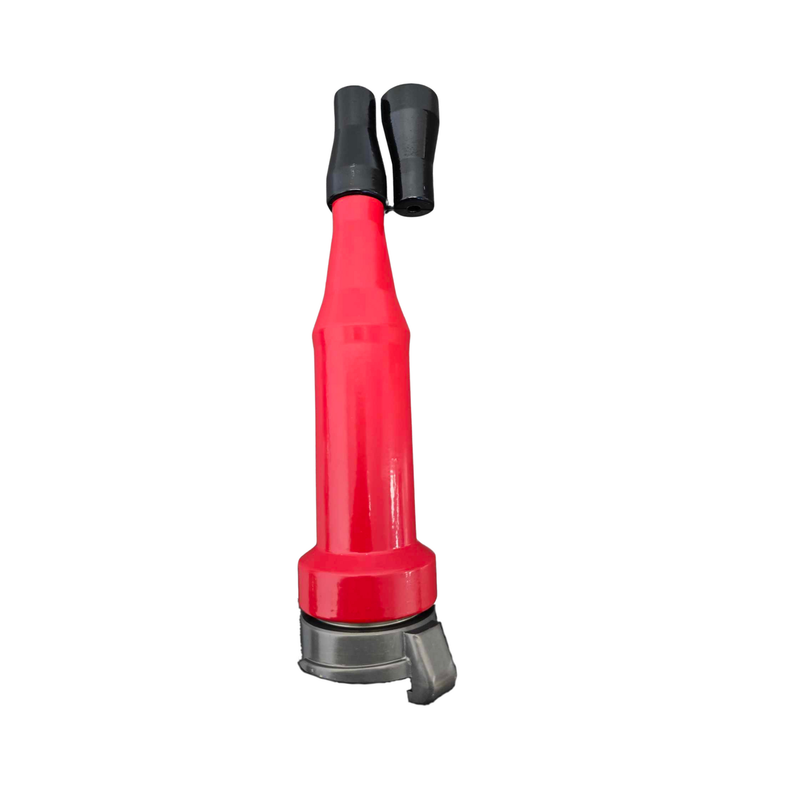
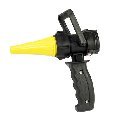
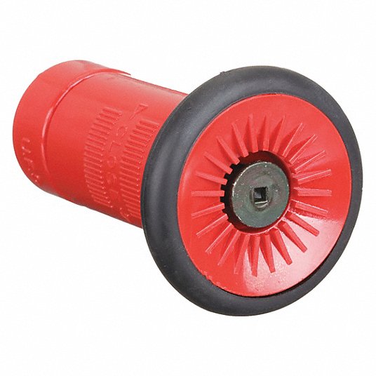
Fire Nozzle – 1.5" NPSH Revolver, 5–8 GPM, Adjustable Flow
$58.74 CAD
"Revolver" Nozzle, adjustable flow patterns, 5 to 8 GPM, 1½" NPSH, Yellow - 4044-NP
Sold out
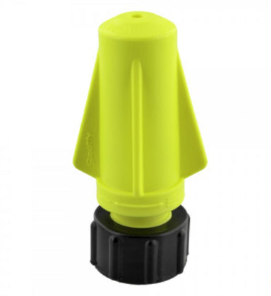
Rocket Nozzle for 4000 Hand Pump, ¾" GHT
$11.60 CAD
Scotty Rocket NozzleThe Scotty Rocket Nozzle is an adjustable nozzle that produces a super fine jet stream...
Brass Sweeper Nozzle
$13.13 CAD
Built from solid brass for durability and resistance to corrosion. It delivers a high-pressure, focused...
Brass Twist Nozzle
$31.49 CAD
Attributes Maximum Operating Pressure 150 PSI (water only) Weight 0.375 lb Break Quantity 1 Optional...

Sold out
Penetrator Nozzle with 1½" NPSH w/ 4085 Connector
$17.49 CAD
¼” tip opening for penetrating deep into the forest duff. Tip opening can be bored...
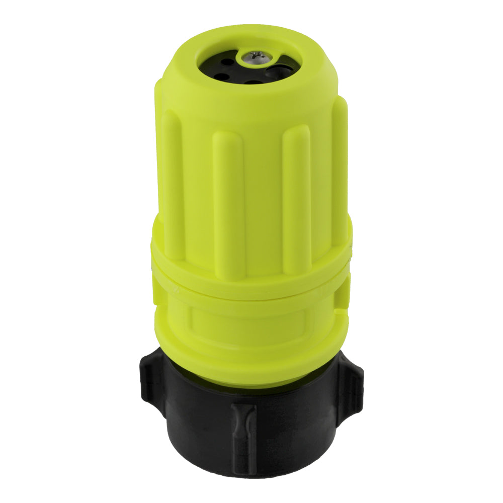
3 GPM Air Aspirating Foam Nozzle, w/ ¾" GHT Female
$18.22 CAD
PRODUCT OVERVIEW: Manufactured from engineering grade, composite polymers for durability at the fire scene. Air...


Sold out
TRAP DOOR HOSE PACK 2- HOSE ROLL
$262.49 CAD
Configure your hoses in rolled or progressive-style with this heavy-duty Wildland Hose Pack. This sturdy...


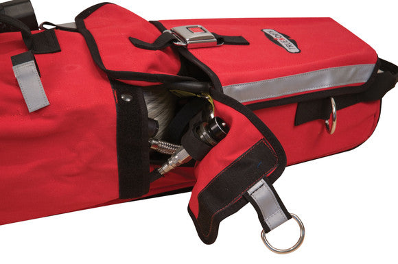
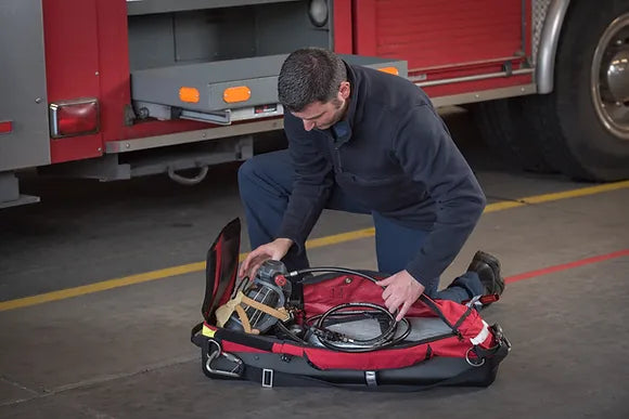
Forestry Hose Bag
$234.00 CAD
The Forestry Hose Bag is designed to meet the rigorous demands of forestry firefighting environments,...
BGHOPPUM PUMPER HOSE BAG
$250.95 CAD
The BGHOPPUM Pumper Hose Bag is engineered for rapid and efficient hose deployment in critical...

Sold out
L- 2 RIT BAG
$329.95 CAD
The ultra tough Iron-Cloth™combined with the Heat-Shield™Nylon 6.6 skid plate makes the L-2 one of...

Sold out
L-3 LITE-SPEED RIT BAG
$485.03 CAD
Perfect for all RIT, F.A.S.T. and R.I.C. operations, the durable, impact-resistant 3D molded Heat-Shield™ Polycarbonate...


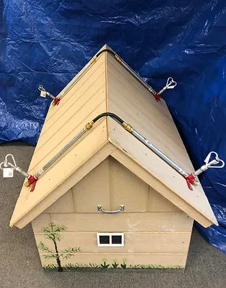
WASP Full Sprinkler Kit – Wildfire-Ready Roof Protection
$229.95 CAD
The Patented WASP Gutter Mount is made in North America and was developed for and...

Roof Sprinkler System Kit - Home Wildfire Defense System
$523.95 CAD
Includes: 4 each 24"x 1/2" aluminum nipple with brass fittings, 4 x Butterfly sprinklers( as shown in picture)...
Sold out
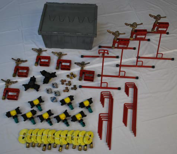
ESM-8 Sprinkler Kit – Mid-Sized Wildfire Zone Coverage
$3,495.00 CAD
Contents8 Elevated Sprinkler Mounts c/w #30 Rainbird Sprinklers8 Ground Spikes 4 OTRs8 1½” x ¾”...
Cabin Sprinkler Package – Compact Wildfire Ember Protection
$5,800.00 CAD
The Cabin Sprinkler Package is designed to provide comprehensive wildfire and ember defense for properties...
Acreage Sprinkler Kit – Wildfire Protection System for Large Properties
$9,838.71 CAD
The Acreage Sprinkler Package is designed to provide comprehensive wildfire and ember protection for large...


Estate Sprinkler Package – Wildfire Protection for Large Properties
$16,560.00 CAD
The Estate Sprinkler Package is designed for large properties, estates, and agricultural land, providing maximum...
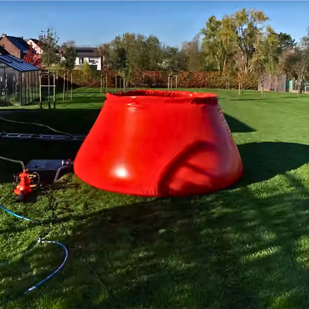
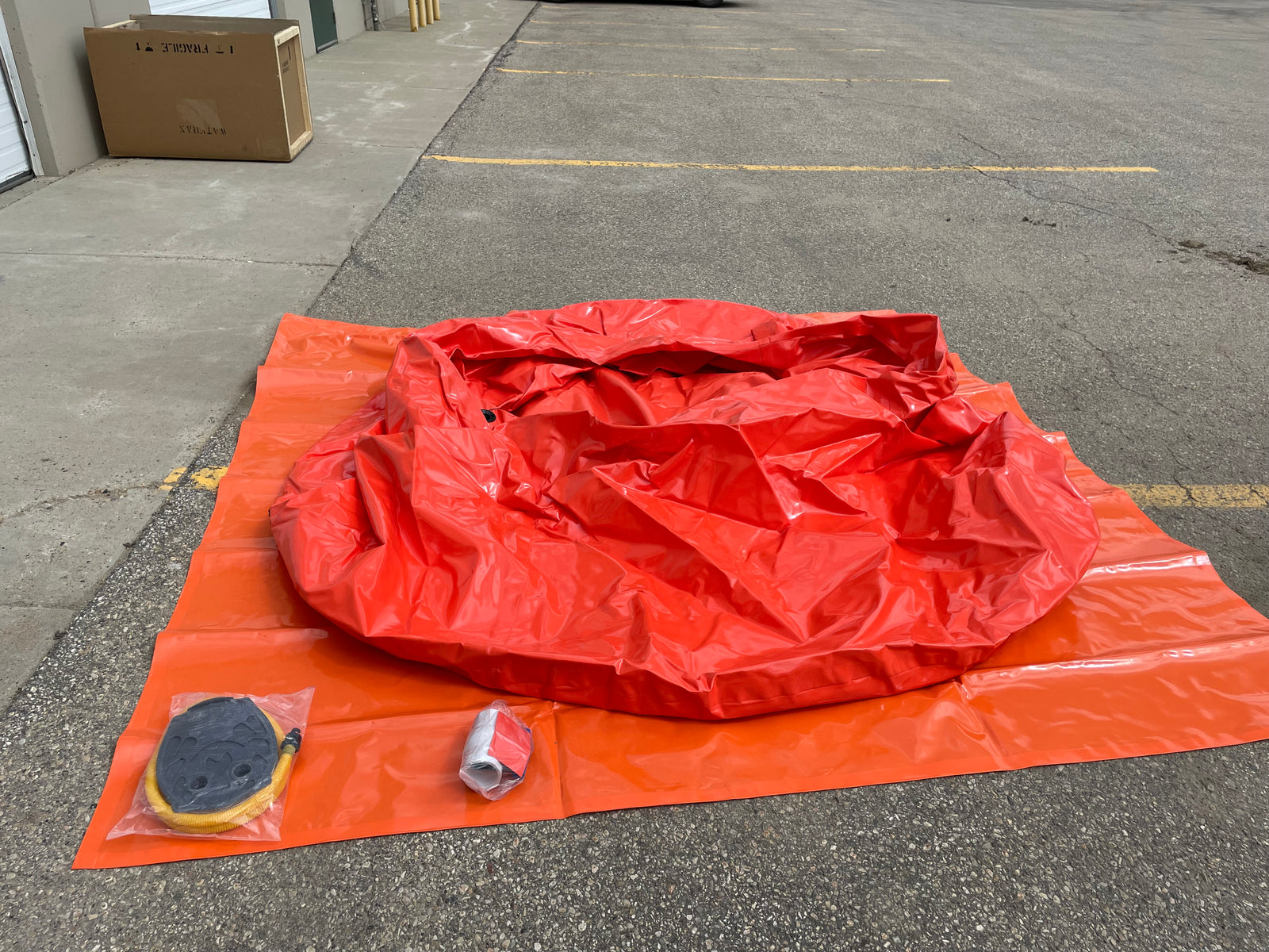
Onion Tank – 1000 Gallon
$750.00 CAD
1000 Gallon Onion Tank - Portable Water Storage for Wildfire Defense and Remote Properties The...

Onion Tank – 2500 Gallon
$1,450.00 CAD
2500 Gallon Onion Tank - Portable Water Storage for Wildfire Defense and Remote Properties The...

Husky® Folding Frame Tank – 1000 Gallon, Portable Containment
$3,295.00 CAD
Product Overview The Husky® Folding Frame Tank is a 1000-gallon portable containment system built for...
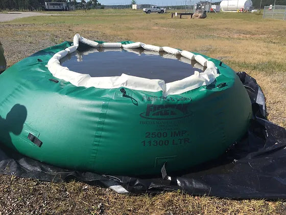

1000 Imp. Gallon Forestry Portable water tank W/Carrying Case and Ground Sheet
$2,295.00 CAD
1000 Imp. Gal forestry tank W/ Foam CollarComes With Ground Sheet and Carry Case

2500 Imp. Gallon Forestry Portable water tank W/Carrying Case and Ground Sheet
$3,144.75 CAD
2500 IMP/3000 us Gal forestry tank W/ Foam CollarComes With Ground Sheet and Carry Case
500 Imp. Gallon Forestry Portable water tank W/Carrying Case and Ground Sheet
$1,975.00 CAD
500 Imp. Gal forestry tank W/ Foam CollarComes With Ground Sheet and Carry Case
1500 Imp. Gallon Forestry Portable water tank W/Carrying Case and Ground Sheet
$2,295.41 CAD
1500 Imp. Gal forestry tank W/ Foam CollarComes With Ground Sheet and Carry Case
2000 Gal Imp. Gallon Forestry Portable water tank W/Carrying Case and Ground Sheet
$2,845.00 CAD
2000 Imp. Gal forestry tank W/ Foam CollarComes With Ground Sheet and Carry Case
Husky® Folding Frame Tank – 3000 Gallon, Portable Containment
$2,920.00 CAD
Product Overview The Husky® Folding Frame Tank is a 3000-gallon portable containment system built for...
Husky® Folding Frame Tank – 2500 Gallon, Portable Containment
$4,147.50 CAD
Product Overview The Husky® Folding Frame Tank is a 2500-gallon portable containment system built for...


Wildland Firefighter Field Cot – 150 kg Aluminum Folding Bed
$149.00 CAD
Built for field comfort during long wildfire deployments, this foldable cot combines durability with easy...


SPU Flagging Tape
$2.50 CAD
SPU Flagging Tape offers 100 meters of durable, high-visibility marking tape, perfect for surveying, forestry,...
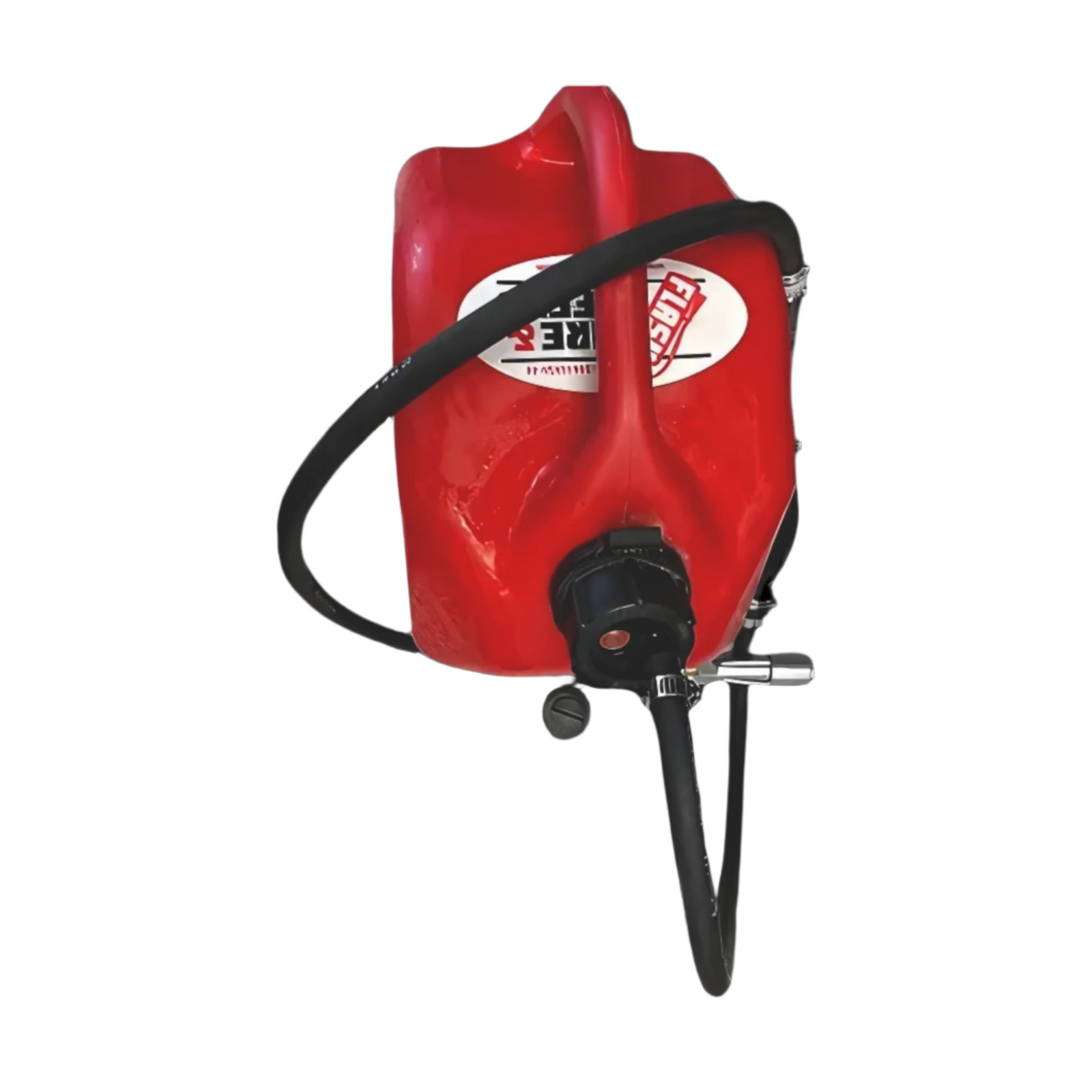
Value Pack
$235.00 CAD
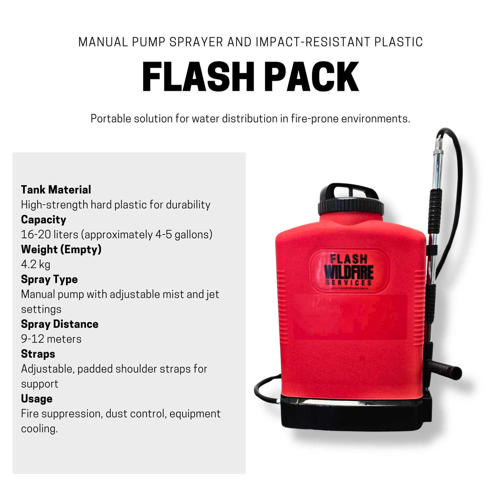
This bundle includes a Pulaski Axe (wood handle), the Flash Pack for portable water suppression,...
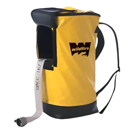
HPO-2X Neoprene Backpack with Brass Pump
$555.45 CAD
The HPO-2X Neoprene Backpack with Brass Pump is a rugged collapsible backpack fire pump designed...
Sale 13%
OT-4NX Poly Backpack With a Brass Pump
$333.11 CAD$289.00 CAD
The backpack hand pump is a valuable tool to quickly deliver water in many fire...


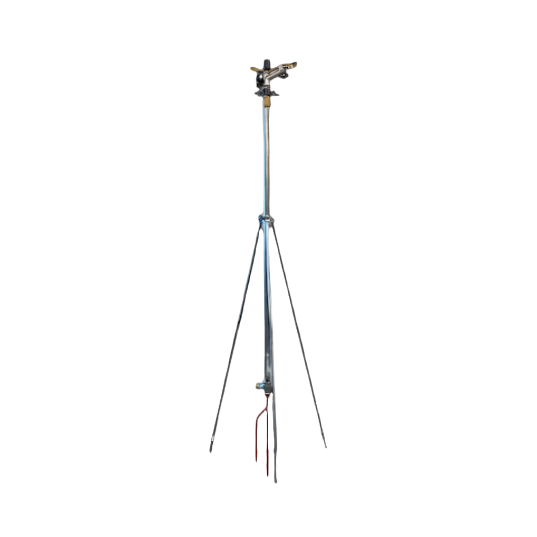

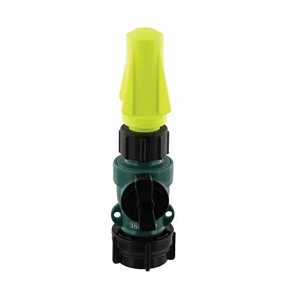
Adjustable Tripod Sprinkler – 1″ Riser for Wildfire Coverage
$249.99 CAD
1" tripod sprinkler set-up designed for efficient water distribution in agricultural, commercial, and residential applications....
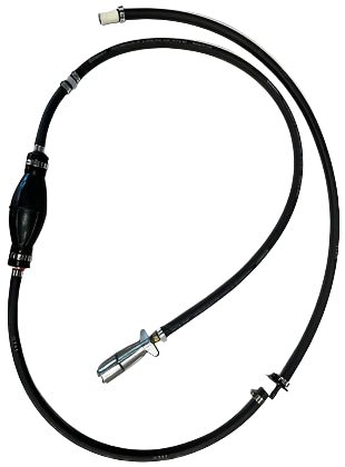
Mark 3 Fuel Line With Mercury Quick Connect
$141.75 CAD
Mark 3 fuel line with universal fuel can adapter, fits any Fuel can to easily...
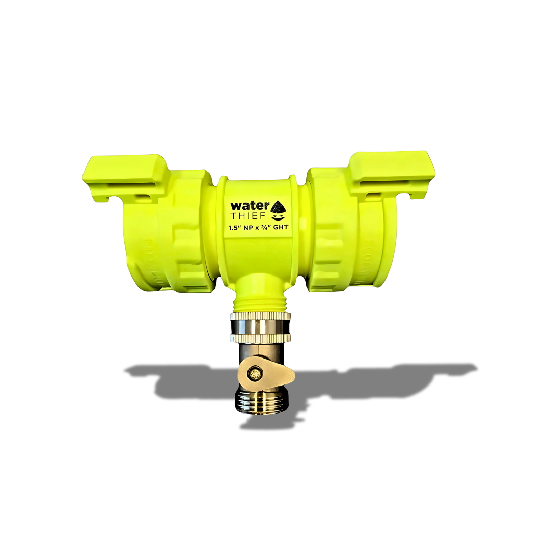
Water Thief – QTQC x QTQC x ¾" GHT
$26.96 CAD
Product Overview This water thief features dual QTQC inlets with a ¾" garden hose thread...


Mystery Ranch

Propper International

True North Gear

Clogger


Wildfires are not only a threat from roaring flames sweeping across the landscape. One of the most destructive — and often underestimated — wildfire dangers is the ember attack. These glowing fragments of burning material can travel kilometers ahead of a fire front, landing on rooftops, decks, yards, and even inside vents. For homeowners living in wildfire-prone areas, understanding ember attacks and preparing against them is one of the most important steps in protecting property and lives.
This guide provides a detailed, fact-based look at ember attacks: how they work, why they’re so dangerous, and what homeowners can do to reduce risk.
1. What Are Ember Attacks?
Embers, sometimes called firebrands, are small pieces of burning debris such as twigs, bark, or pinecones that are lifted into the air by the heat and wind of a wildfire. These glowing fragments can remain hot enough to ignite new fires long after leaving the main flames.
When carried by strong winds, embers can rain down on communities kilometers away from the fire front. This process — known as an ember attack — is responsible for the majority of home ignitions during major wildfires.
Research consistently shows that 50–90% of homes lost in wildfires ignite from embers rather than direct flame contact.
Embers can be as small as a grain of sand or as large as a fist-sized chunk of bark.
They often penetrate gaps, accumulate in corners, and ignite combustible materials such as dry leaves, firewood piles, or wooden decks.
2. Why Ember Attacks Are So Dangerous
Ember attacks are particularly hazardous because they bypass the visible threat of a fire front. Even if flames never reach your home, embers alone can cause ignition.
Key risks include:
Long-distance travel: Strong winds can carry embers more than 10 km ahead of the main fire.
Multiple ignition points: Unlike flames, which approach from one direction, embers can fall on a property from all sides at once.
Hidden vulnerabilities: Embers lodge in roof valleys, gutters, under decks, and inside attic vents — areas that are often overlooked in fire defense.
Rapid ignition: A single ember landing on dry leaves in a gutter can ignite a fire that spreads into the attic within minutes.
3. How Ember Attacks Ignite Homes
Understanding the pathways embers take is critical for reducing risk. The most common ignition points include:
Roofs and Gutters
Leaves, pine needles, and debris in gutters are highly flammable fuel beds for embers.
Wooden shingles or untreated shakes can ignite if embers accumulate.
Vents and Openings
Embers can enter through attic vents, crawlspace vents, or gaps in siding.
Once inside, they may ignite insulation, stored items, or wood framing.
Decks and Porches
Wooden decks act as landing zones for embers, particularly if leaves are trapped underneath.
Embers falling between deck boards can ignite dry materials below.
Yard and Landscaping
Mulch, woodpiles, dry grasses, and shrubs near the home are common ember ignition points.
Wooden fences attached to homes act as fire “wicks,” carrying fire directly to walls.
Outdoor Furniture and Accessories
Cushions, mats, and plastic furniture can catch fire quickly when exposed to embers.
4. Lessons from Past Wildfires
Real-world wildfire events highlight the devastating role of ember attacks:
Fort McMurray, Alberta (2016): Entire neighborhoods were destroyed primarily due to ember-driven spot fires that leapt across streets and green belts.
Paradise, California (2018): The Camp Fire spread embers miles ahead of the main front, overwhelming the town’s defenses and causing catastrophic losses.
Australia’s Black Saturday Fires (2009): Investigations found that embers were responsible for up to 85% of home ignitions.
The pattern is clear: homes do not need to be in the direct path of flames to be destroyed. Ember storms alone are often sufficient.
5. Homeowner Vulnerabilities
From Flash Wildfire’s customer segment analysis, homeowners face three consistent challenges when it comes to wildfire risk:
Lack of knowledge about how fires spread and where their homes are vulnerable.
Limited access to equipment or resources to defend their properties.
Misplaced confidence that distance from forests or visible flames means safety.
These factors combine to make ember attack awareness and preparation a top priority.
6. How to Prepare Your Home Against Ember Attacks
The most effective defense against ember attacks is a combination of home hardening (improving the structure itself) and defensible space (managing the surrounding landscape).
Step 1: Roof and Gutter Safety
Replace combustible roofing with fire-resistant materials (metal, tile, asphalt shingles rated Class A).
Keep gutters clear of leaves, needles, and debris.
Install gutter guards made of metal mesh to block accumulation.
Step 2: Vents and Openings
Cover attic and crawlspace vents with 1/8-inch metal mesh to prevent ember entry.
Seal gaps in siding, eaves, and roof intersections.
Install ember-resistant vents where possible.
Step 3: Decks, Porches, and Fences
Use fire-resistant materials when building or retrofitting decks.
Remove combustible items stored underneath.
Disconnect wooden fences from the house or replace connecting sections with noncombustible material such as metal gates.
Step 4: Yard and Landscaping
Maintain a noncombustible zone within 1.5 meters of the house — gravel, stone, or concrete instead of mulch.
Store firewood, lumber, and propane tanks at least 10 meters from structures.
Trim trees so branches are at least 2 meters above the ground and clear of the roof.
Remove dead vegetation, tall dry grass, and ladder fuels (vegetation that allows fire to climb).
Step 5: Outdoor Items
Use fire-resistant cushions and covers on patio furniture.
Store lightweight, flammable items indoors during fire season.
Step 6: Emergency Equipment
Homeowners may not need the industrial-scale gear used by emergency services, but access to basic fire defense tools can make a difference. This includes:
Fire extinguishers (placed inside and outside).
Garden hoses long enough to reach all parts of the home.
Roof or perimeter sprinkler systems designed for ember suppression.
Portable water pumps and small water tanks for rural properties.
7. The Role of Defensible Space
Defensible space is the managed area around a home designed to slow fire spread and reduce ember ignition risk. Many fire agencies divide defensible space into zones:
Immediate Zone (0–1.5 m): Absolutely no combustible material.
Intermediate Zone (1.5–10 m): Manage shrubs, remove ladder fuels, and keep lawns watered.
Extended Zone (10–30 m): Thin trees and clear deadwood to slow approaching fires.
For homeowners in semi-rural areas, extending these principles out to 100 m provides even greater protection.
8. Community-Level Considerations
Individual preparation matters, but ember attacks are often community-wide events. Neighborhoods where multiple homes ignite simultaneously can overwhelm fire services. That’s why FireSmart Canada and similar programs stress coordinated action:
Encourage neighbors to clean gutters and yards at the same time.
Share resources such as pumps and sprinklers.
Work with local municipalities to maintain green belts and roadways.
9. Insurance and Ember Attacks
Insurance companies recognize ember attacks as a leading cause of wildfire-related claims. Some insurers now require evidence of mitigation efforts — such as cleared defensible space or Class A roofing — before offering or renewing coverage in high-risk zones.
Homeowners who take proactive steps may qualify for reduced premiums or wildfire resilience incentives. Always check with your provider about documentation requirements.
10. Common Myths About Ember Attacks
“I live in the suburbs, not the forest, so I’m safe.”False. Embers can travel into towns and cities, igniting homes well away from forests.
“If the fire front doesn’t reach me, I don’t need to worry.”False. Ember storms alone can destroy entire subdivisions without flames ever touching them.
“A garden hose is all I need.”False. While hoses are useful, they cannot replace structural hardening and landscape management.
11. Building Long-Term Resilience
Protecting against ember attacks is not a one-time task but an ongoing process. Homeowners should:
Conduct seasonal inspections before wildfire season.
Participate in FireSmart or local wildfire preparedness workshops.
Advocate for community-wide fire mitigation projects.
Invest in upgrades gradually — starting with the most vulnerable areas like roofs and vents.
12. Checklist for Homeowners
Here’s a quick summary checklist:
Roof: Class A fire-resistant materials, clean gutters.
Vents: Covered with 1/8-inch metal mesh, sealed gaps.
Decks/Fences: Fire-resistant materials, no combustibles stored underneath.
Landscaping: 1.5 m noncombustible zone, trimmed trees, removed ladder fuels.
Outdoor Items: Cushions, mats, propane tanks stored safely.
Emergency Tools: Fire extinguishers, hoses, sprinklers, portable pumps.
Community: Coordinate with neighbors, join FireSmart initiatives.
Roof: Install Class A fire-resistant roofing materials and keep gutters clear of leaves and debris. Consider adding rooftop sprinkler systems designed for wildfire defense. These systems create a water curtain across the roof and surrounding structure, helping to reduce ignition risk from falling embers.
Conclusion
For homeowners in wildfire-prone areas, the greatest threat is not always the towering flames of a wildfire but the silent rain of embers that can ignite a home from within. Ember attacks account for the majority of home losses in wildfires, and yet many property owners remain unaware of their destructive potential.
By understanding how ember attacks work, addressing vulnerabilities, and taking proactive steps to harden both structures and landscapes, homeowners can significantly reduce their risk. Preparation does not guarantee survival, but it greatly improves resilience — and gives fire services a fighting chance to protect homes and communities.

For as long as communities have faced the threat of wildfires, detection has been one of the most critical factors in protecting people, property, and natural landscapes. Generations of wildland firefighters, incident commanders, and local volunteers have relied on their eyes, ears, and deep familiarity with the land to spot trouble early. From the days of lookout towers perched on ridges to aerial patrols scanning vast stretches of forest, these traditional methods have saved countless lives and limited devastating losses. Today, as fire seasons grow longer, hotter, and more unpredictable, new tools are emerging that promise to work alongside those time-tested approaches—giving crews the ability to respond faster, more precisely, and with greater safety.
Artificial intelligence, satellite imaging, autonomous drones, and ground-based sensor networks are no longer just concepts for the future. They are here now, being deployed in active fire zones across the world. Rather than replacing the judgment and skill of seasoned firefighters, these technologies are designed to enhance their capabilities, delivering better information in less time and under conditions where human observation alone may not be enough. By combining the hard-earned knowledge of experienced crews with the reach and precision of modern detection systems, agencies can build a multi-layered defense against one of nature’s most destructive forces.
The Evolution of Wildfire Detection
For decades, wildfire detection relied primarily on human observation. In the early 20th century, lookout towers were a common sight in fire-prone regions across North America. Staffed by trained observers who could spot smoke plumes from miles away, these towers were a frontline defense during peak fire season. Aerial reconnaissance later became an important supplement, with small planes flying regular patrols over remote areas. In more recent decades, cameras and weather monitoring stations began to play a role, expanding the scope and consistency of coverage.
These methods remain vital. Even in the era of high-resolution satellite imagery, a seasoned firefighter who knows the terrain can often detect subtle signs of a problem that technology might miss. But the challenge today is scale. Wildfire seasons are starting earlier, lasting longer, and often overlapping with extreme weather events that strain resources. Detection systems that can cover vast areas continuously, regardless of weather or daylight, have become essential complements to the traditional playbook.
Satellites Bringing a New Perspective
One of the most significant developments in modern wildfire detection is the deployment of low-Earth orbit satellite constellations designed specifically for environmental monitoring. Projects like FireSat—developed in partnership with Muon Space and the Earth Fire Alliance—are at the forefront of this movement. FireSat’s network of satellites uses visible, short-wave infrared, and thermal imaging to detect heat signatures from wildfires. With the ability to scan large areas every 15 minutes and detect hotspots as small as five meters across, these satellites can identify potential fires well before they become visible to ground crews or aircraft.
In practice, this means that a fire sparked by lightning in a remote canyon could be detected, verified, and reported to the appropriate agencies before smoke has even reached the canopy. This kind of speed is critical, especially in wind-driven conditions where minutes can make the difference between a controllable blaze and a fast-moving disaster. The data from these satellites doesn’t just provide coordinates—it delivers thermal maps, fire perimeter outlines, and ongoing updates as conditions change. When integrated into command centers, this information allows for faster decision-making and better allocation of suppression resources.
Artificial Intelligence Enhancing Accuracy
While satellites provide the “eyes” in the sky, artificial intelligence supplies the processing power to make sense of the massive volumes of data they generate. AI algorithms are trained to recognize the unique thermal and visual patterns of wildfires, filtering out false positives caused by industrial activity, solar reflections, or other heat sources. In some systems, AI can cross-reference satellite data with ground-based weather readings and historical fire behavior models to predict how a blaze might spread under current conditions.
This predictive capability is not intended to replace human judgment. Instead, it acts as an advisory layer, giving incident commanders a clearer picture of possible scenarios so they can plan accordingly. For example, if AI analysis suggests that a small ignition is likely to run upslope toward a populated area within hours, suppression resources can be pre-positioned for a rapid response. These models can also help crews anticipate changes in fire intensity or direction caused by shifting winds, allowing for safer operations and more effective containment strategies.
Ground-Based Sensors: Detecting Fires at the Source
Not all detection happens from above. Increasingly, fire agencies are deploying ground-based sensor networks in high-risk zones. These compact, weather-hardened devices monitor environmental variables such as temperature, humidity, wind speed, and air quality. Some are equipped with infrared or optical cameras capable of spotting smoke or flames in their field of view. When readings exceed established thresholds, the sensors send automated alerts to command centers, often with GPS coordinates and live data streams.
The advantage of ground sensors is their ability to detect fires in areas where satellites might have limited visibility due to cloud cover or dense smoke. They also operate continuously, regardless of time of day, and can be strategically placed along powerline corridors, in recreation areas, or near critical infrastructure. In regions where human patrols are limited, these sensors act as an ever-present watch, complementing both traditional observation and aerial detection systems.
Drone Technology Extending Reach and Capability
Drone technology has advanced rapidly in the last decade, and wildfire applications are among the most promising uses. Drones can be deployed quickly to assess a reported ignition, capturing high-resolution imagery and thermal data without putting personnel in harm’s way. In active fire zones, drones can fly at night or through dense smoke where piloted aircraft may be grounded, identifying hotspots and mapping fire perimeters in real time.
Some emerging systems involve drone swarms—multiple autonomous units working in coordination to cover large areas or deliver payloads of water or fire retardant. While still in the testing phase, these systems have the potential to provide targeted suppression in areas that are otherwise inaccessible, buying valuable time for ground crews to establish control lines. For reconnaissance and damage assessment after a fire, drones can quickly capture imagery that would take days to gather by foot or vehicle.
Integration: Building a Layered Detection Network
The true power of these technologies lies in integration. A modern wildfire detection strategy might involve satellites scanning broad regions, AI analyzing the data for signs of fire, ground sensors confirming localized conditions, and drones providing immediate visual verification. This layered approach reduces the risk of missed detections, shortens response times, and gives crews the best possible information for making tactical decisions.
Importantly, this model does not diminish the role of human expertise. Firefighters, dispatchers, and incident commanders bring critical judgment, adaptability, and situational awareness that no machine can replicate. Technology is a force multiplier, extending the reach and precision of human efforts, not replacing them.
Respecting the Legacy While Embracing the Future
Seasoned firefighters have built a legacy of resilience and dedication. The tools of the trade—hand crews cutting fire lines, water tenders holding perimeters, aerial drops from helicopters and fixed-wing aircraft—are still as vital today as they were decades ago. What is changing is the speed and precision with which fires can be detected and analyzed, giving those same crews the advantage of acting earlier and with more targeted strategies.
By respecting the experience of the past and integrating the tools of the future, agencies can create a balanced approach that draws on the strengths of both. Lookout towers, patrols, and community reporting remain foundational, but when paired with satellite imagery, AI modeling, and real-time sensor data, they become part of a more comprehensive, resilient defense against wildfire threats.
Looking Ahead
The coming years are likely to bring even greater integration of technology into wildfire management. Expanding satellite networks, improved AI algorithms, and more affordable sensor systems will make advanced detection accessible to more jurisdictions. As interoperability between agencies improves, data sharing will become faster and more efficient, ensuring that detection in one region can benefit crews across an entire network.
For communities, the message is clear: investment in early detection technology is an investment in safety, efficiency, and resilience. By supporting both the tried-and-true methods and the latest innovations, we can ensure that the next generation of wildland firefighters is equipped to face the challenges of an evolving fire landscape—without losing the invaluable knowledge passed down from those who came before.